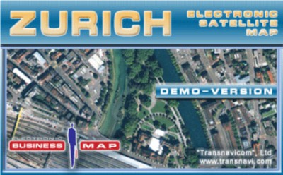
Transnavicom Satellite Map of Zurich 1.0
 Demo-version of Satellite Map of Zurich!
Transnavicom Satellite Map of Zurich is one of the newest progressive experience and developments of Transnavicom (www.
|
Demo-version of Satellite Map of Zurich!
Transnavicom Satellite Map of Zurich is one of the newest progressive experience and developments of Transnavicom (www.transnavi.com), professionalism of our specialists, aspiration and wish to do our favourite thing give us a chance to create such high-quality and unique products! Face the reality!
Your dreams are coming true with satellite maps from Transnavi.com. In the demo-version you can get acquainted with a district of Zurich, use address-search functions and measure the distance between any number of points!
Basic properties of the programme demo-version:
tags![]() the map demo version information about any number between any satellite map transnavi com
the map demo version information about any number between any satellite map transnavi com

Download Transnavicom Satellite Map of Zurich 1.0
![]() Download Transnavicom Satellite Map of Zurich 1.0
Download Transnavicom Satellite Map of Zurich 1.0
Authors software
 Transnavicom Satellite Map of Zurich 1.0
Transnavicom LTD
Demo-version of Satellite Map of Zurich!
Transnavicom Satellite Map of Zurich is one of the newest progressive experience and developments of Transnavicom (www.
Similar software
 Transnavicom Satellite Map of Zurich 1.0
Transnavicom LTD
Demo-version of Satellite Map of Zurich!
Transnavicom Satellite Map of Zurich is one of the newest progressive experience and developments of Transnavicom (www.
 Zurich Show Screensaver 1.02
EasyZurich.com
Zurich Show Screensaver is a slideshow with 25 pictures of urban landscapes of various areas in Zurich (Lindenhof, Guild houses, Old town (Altstadt), District 1, Bahnhofstrasse, Parade-Platz, Botanical Garden of the University of Zurich, Chinese Garden, Zurich, Neu Oerlikon, Lake Zurich, Uetliberg, Fluntern Cemetery and more.
 StreetFinder 3.0
DolSoft Incorporated
StreetFinder - This software helps the user to find streets, administrative places, tourist places… in big cities of Vietnam such as: Ho Chi Minh, HaNoi, Hue, Da Nang, Nha Trang, Da Lat, Bien Hoa, Can Tho, and especially in this new version, version 3.
 NeonJax 3D 1.0.2
Fascination Software
NeonJax3D is a software-rendered 3D screensaver demo which supports stereo LCD glasses.
 Google Earth 4.0.2722
Google
With Google Earth you can explore the earth from above!
Want to know more about a specific location? Dive right in -- Google Earth combines satellite imagery, maps and the power of Google Search to put the world's geographic information at your fingertips.
 93 Photo Street 1.3.1
Transmutable
A photo map displays your images arranged by location instead of by time.
 ETH Lecture Communicator .0 Beta 1
Laboratory for Software Technology
ETH Lecture Communicator is a useful tool that will improve the interaction in the classroom between instructor and students.
 ActiveProperties 3.2.3
Logic Dreams s.a.s.
The ActiveProperties control provides you with a very simple way to visualize and to represent a set of properties.
 TerraViewer 1.1
Minh T. Nguyen
TerraViewer makes use of Microsoft's free TerraService web service to retrieve and display archived satellite images and topographic maps of any region in the United States.
 Daily Picture Of Zurich 1.0.1
sam
Other software in this category
 Smoke Attack 1.0
Blackpencil Entertainment AG
In this smoking-risk awareness game from the swiss federal office of public health, you are navigating the caracter "Oxy" through offices.
 Quiz of the States 1.0 Rev. 2
States Liberty Party
Makes learning enjoyable.
 AIDA 4.3a
AIDA
AIDA will allow users the chance to easily simulate the effects of changes in insulin and diet on the blood glucose profiles of various example 'virtual diabetic patients'.
 nVIDIA EarthViewer 3D 1.4.2
nVIDIA
EarthViewer 3D harnesses the power of NVIDIA GPUs.
 ViziFlow 2.3
John Beeteson
ViziFlow is a program that allows the fast fluid flow modeling, and the visualization of pressure distribution and streamlines.