GPS Mapper 0.1.2-103
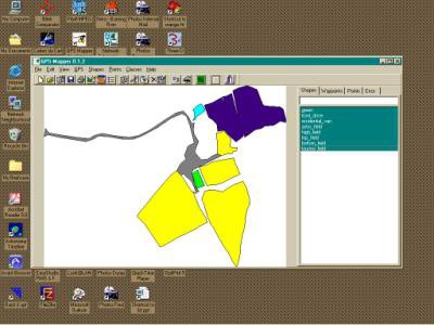
 Although not strictly related to astronomy, GPS Mapper is an application that allows you to download waypoints from a Garmin GPS handset and then map out the points into areas.
|
Although not strictly related to astronomy, GPS Mapper is an application that allows you to download waypoints from a Garmin GPS handset and then map out the points into areas.
GPS Mapper currently only reads from a Garmin GPS. Communications are very simple, and once the waypoints are downloaded, they can be mapped straight away.

Download GPS Mapper 0.1.2-103
Authors software
 GPS Mapper 0.1.2-103
Trefach Astronomy Centre
Although not strictly related to astronomy, GPS Mapper is an application that allows you to download waypoints from a Garmin GPS handset and then map out the points into areas.
Similar software
 GPS Mapper 0.1.2-103
Trefach Astronomy Centre
Although not strictly related to astronomy, GPS Mapper is an application that allows you to download waypoints from a Garmin GPS handset and then map out the points into areas.
 EasyGPS 2.3.8
TopoGrafix
EasyGPS is the fast and easy way to create, edit, and transfer waypoints and routes between your computer and your Garmin, Magellan, or Lowrance GPS.
 Gif Colour Mapper 1.0
SilverAge Software
GIF Color mapper application provides for quick colors modification in the palettes of a number of GIF files.
 Port Mapper 1.40
KMiNT21 Software
This is a very simple command-line port mapper (port redirector).
 Handy Image Mapper 1.0
SilverAge Software
Handy Image Mapper will let you easily create and insert image maps into HTML documents to arrange your site navigation by means of images.
 TomaWeb Image Mapper 1.0
TomaWeb Tech.
The TomaWeb Image Mapper represents a utility that will allow you to easily create area maps for the graphics on your website.
 OZItoFugawi 1.0.10
American Outland
This free tool was developed by American Outland and allows you to convert any OZIExplorer data file (Waypoints, routes, tracks, events and points files) into text files directly supported by Fugawi for importing.
 GPS Altitude Chart 1.2
Michael Steger
Did you ever want to print or publish the altitude profile of a tracklog recorded with a GPS receiver? As long as you are using Garmin software you probably were not too happy - at least I wasn't! Now there is a better way to generate an elevation plot:
GPS Altitude Chart application is one solution to these problems.
 ToCyrillic 0.5.10
Alex Benenson
ToCyrillic is a transliterator and a keyboard mapper for Mozilla Firefox & Thunderbird.
 QuikGrid 5.3
Perspective Edge Software
QuikGrid is an application which will read in a set of scattered data points (x, y, z) which represents a surface.
Other software in this category
 CleanCIH 1.6
Proland
Clean your PC from the Win95.
 Klez Removal Tool 1.0.11
Symantec Corporation
W32.
 WinImp 1.21
Technelysium
WinImp is a new file archiver which not only recognises common archive formats, but also introduces a new, high performance archive format.
 Softpit PC Search Light 1.3
Goldmarc Technology AS
The softpit PC search light is a useful utility for people who need to find critical information fast and precisely on their own computer.
